Tracking El Nino
Air Date: Week of October 13, 2006

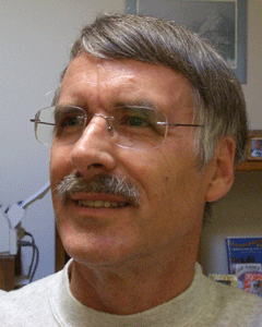
Dr. Kevin E. Trenberth is Head of the Climate Analysis Section at the National Center for Atmospheric Research. (Courtesy of The National Center for Atmospheric Research)
Another El Nino in on the way this winter, which might not be such a bad thing. Scientific evidence shows that El Nino's can have a calming effect on hurricane activity in the Atlantic. Host Steve Curwood talks with Dr. Kevin Trenberth, head of the Climate Analysis Section at the National Center for Atmospheric Research about the El Nino effects.
Transcript
CURWOOD: This year’s Atlantic hurricane season won’t be over until the end of November, but compared to the triple threat fury of Katrina, Rita and Wilma in 2005, so far in the U.S. things have been tame. And, that scientists say, is due in part to the emergence of another El Niño. Usually, thanks to trade winds, the Western side of the Pacific Ocean is warmer than the East, but sometimes the warm water spreads out, changing weather patterns.
To explain this El Niño effect we turn to Kevin Trenberth, who is head of the Climate Analysis Section at the National Center for Atmospheric Research in Boulder, Colorado. Hello sir!
TRENBERTH: Hello, I’m pleased to be here.
CURWOOD: Now, how could this developing El Niño have effected our hurricane season? What did it do to hurricanes?
TRENBERTH: The developing El Niño shifts activity out into the Pacific. And that has a very large scale atmospheric circulation throughout the globe. Sort of like a very large monsoon kind of pattern that has an adverse effect on the atmospheric conditions in the Atlantic in terms of the ability to form vortices in the Atlantic. This relates to windsheer and makes it less favorable for hurricanes to form.

Dr. Kevin E. Trenberth is Head of the Climate Analysis Section at the National Center for Atmospheric Research. (Courtesy Of: The National Center for Atmospheric Research)
TRENBERTH: Well that’s what happens with the windsheer, yes. As these vortices begin to form they sort of blow apart and they can’t sustain themselves very well.
CURWOOD: Now the last major El Niño event was what, the winter of ’97-’98. And I just remember pictures of endless mudslides and rain in California and that sort of thing. How strong might it be this year and how might it be felt in the United States?
TRENBERTH: Oh, they’re certainly not predicting anything quite like that at the moment. There’s been some other El Niño events since then. There was a moderate one in 2002-2003. And this looks like at the moment more of that kind of magnitude. So it doesn’t have the global ramifications that the ‘97-’98 event was. And that’s when the name El Niño sort of came into the vernacular if you like.
CURWOOD: Come January, what are we likely to be seeing then on the national weather pattern?
TRENBERTH: In the United States in the winter time, which is when the El Niño tends to peak, it causes the storm track to shift southwards. The last example we had of this was a relatively weak El Niño in 2004-2005. The storms were barreling into Southern California and moving across the southern states and across into Florida. But that was enough to wipe out the drought in the Southwestern part of the United States. Some of those storms can then turn and barrel up the East Coast and you can end up having quite a nice snowstorm out of this in the East Coast. And meanwhile, Washington and Oregon and the far western parts of Canada are apt to be a little bit drier and sunnier.
CURWOOD: The El Niño I gather has been around for a long time, but I’m wondering if you scientists are seeing it occur more often and more intense and if so how that might be related to global climate change.
TRENBERTH: There’s certainly theoretical reasons as to why these should be related because El Niño involves moving heat around in the Pacific Ocean and global climate change involves moving heat around in the atmosphere and in the oceans and so on. So I think there’s gotta be some kind of changes. And the models do predict changes further out in the future. So this is a really serious issue especially for the Pacific Rim countries and it greatly effects the nature of climate change across the US.
CURWOOD: How?
TRENBERTH: Well what has happened in recent times is that the eastern part of the US has become wetter and cloudier and a bit, well I mentioned the increase in rainfall. And the main warming that has occurred in the US has been in the Western parts of the US and up into Alaska. Maybe this has altered perceptions about the nature of the global climate change that is going on because the Eastern US has not warmed up as much as Europe has for instance.
CURWOOD: Dr. Kevin Trenberth is head of the Climate Analysis section for the National Center for Atmospheric Research. Thank you, Sir.
TRENBERTH: You’re most welcome.
Links
Living on Earth wants to hear from you!
Living on Earth
62 Calef Highway, Suite 212
Lee, NH 03861
Telephone: 617-287-4121
E-mail: comments@loe.org
Newsletter [Click here]
Donate to Living on Earth!
Living on Earth is an independent media program and relies entirely on contributions from listeners and institutions supporting public service. Please donate now to preserve an independent environmental voice.
NewsletterLiving on Earth offers a weekly delivery of the show's rundown to your mailbox. Sign up for our newsletter today!
 Sailors For The Sea: Be the change you want to sea.
 The Grantham Foundation for the Protection of the Environment: Committed to protecting and improving the health of the global environment.
 Contribute to Living on Earth and receive, as our gift to you, an archival print of one of Mark Seth Lender's extraordinary wildlife photographs. Follow the link to see Mark's current collection of photographs.
 Buy a signed copy of Mark Seth Lender's book Smeagull the Seagull & support Living on Earth

