Mapping Climate Change
Air Date: Week of March 13, 2009
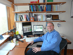
Josef Kellndorfer (Photo: Bruce Gellerman)
Satellites play a critical role in monitoring and preserving the world’s tropical forests. The eyes in the sky have revolutionized our world view but they may not be up to the task in the future. Host Bruce Gellerman looks at the future of remote earth sensing satellites.
Transcript
GELLERMAN: As we mentioned, the president has chosen John Holdren as his science advisor. Holdren is a physicist by training and a professor of environmental policy at Harvard. Until he took a leave of absence he was investigating the causes and consequences of global climate change.
Holdren also had to step down as the director of The Woods Hole Research Center in Falmouth, Massachusetts.
Woods Hole is an independent institute focusing on environmental science, education and public policy. Living on Earth’s Executive Producer Steve Curwood is on the Center’s Board of Trustees.
While he’s been there many times, I only got my first chance recently when I drove down to do some interviews for this story about using satellites to monitor deforestation and climate change.
So I took out my trusty GPS and promptly got lost. I eventually found Woods Hole. But you can’t always depend on Google Earth, says Josef Kellndorfer, and he should know. He’s an expert in satellite pictures of Earth at the research center.
KELLNDORFER: Google Earth is a beautiful system which we use tremendously even now in science but it’s still in the stages of being a static system where we get maps that are possibly a couple years old.
GELLERMAN: Kellndorfer is an associate scientist at Woods Hole. He uses remote sensing technology to monitor the health of our planet.
KELLNDORFER: I usually describe myself as one of the radiologists on staff and the patient is the Earth.
GELLERMAN: On the corridor walls and offices at Woods Hole Research Center are poster size photos taken from space, showing the patient in exquisite detail.
We stop in front of one particularly spectacular shot of the Amazon Rainforest taken by Landsat, the granddaddy of all remote earth sensing satellites.
KELLNDORFER: You know Landsat has been the workhorse of remote sensing for 30 some odd years.
[LANDSAT SOUNDS]
KELLNDORFER: We’re into the final half minute of the count down now of the Delta II with Landsat 7…t minus 20 seconds..everything go at this time…
GELLERMAN: The Landsat program, began in 1972. The launch of Landsat One put into orbit the first satellite designed to specifically study and monitor the planet’s landmasses…
[LANDSAT SOUNDS “SIX …. FIVE …. FOUR…”]
GELLERMAN: Landsat 7 launched in 1999 is the most recent.
KELLNDORFER: Main engine start and lift off of the Delta II rocket with the advanced Landsat 7 space craft.
Josef Kellndorfer (Photo: Bruce Gellerman)
GELLERMAN: Landsat 7 quit after four years is space, but Landsat 5 is still going strong. This month marks its 25th year of sending pictures of Planet Earth back from space.
Woods Hole Research Center Senior Scientist Scott Goetz says Landsat has created a unique historical archive.
GOETZ: Landsat really changed our worldview I think because it just suddenly we were able to look at maps of land use change and the application of Landsat imagery was just amazing how it became used in just about every science application you can imagine.
GELLERMAN: Landsat has documented the formation of volcanoes, floods, cyclones and earthquakes, even sending photos from space of President Obama’s inauguration.
Now Landsat 5 and Earth orbiting satellites launched by the United States and other countries are going to be given a new job: monitoring climate change. But Yvo De Boer, head of the United Nations Framework Convention on Climate Change fears the satellites may not be up to the task.
DE BOER: Being able to measure what is happening is incredibly important to developing a robust international climate change response. You wouldn’t expect it in this modern day and age but actually our ability to monitor greenhouse gas emissions is relatively weak.
GELLERMAN: The problem is the sensor technology. It’s not just old, it’s old school. Again, Woods Hole scientist Josef Kellndorfer.
KELLNDORFER: One of the Landsat shortcomings is that it’s an optical sensor, so there are regions that you don’t get images for several years because of the cloud cover.
GELLERMAN: Being able to take images through clouds and at night is critical for monitoring the health of the world’s tropical forests trees store carbon, and deforestation and destruction of these vast forests accounts for roughly a fifth of greenhouse gas emissions. That’s where ALOS comes in.
[SOUND OF JAPANESE SATELLITE LAUNCH]
GELLERMAN: Two years ago the Japanese space agency launched a new era in remote sensing systems: ALOS- the Advanced Land Observing Satellite
[SOUND OF JAPANESE SATELLITE LAUNCH]
GELLERMAN: Aboard ALOS is a sensor called PALSAR. It uses radar to take images of earth. Radar’s long wavelengths can penetrate clouds.
There are a number of radar frequencies used in remote sensors. Joseph Kellndorfer uses a mnemonic device to keep track of them.
KELLNDORFER: From long to short wavelengths it’s p-l-c-x. And I call it Peter Loves Claudia’s Xylophone.
GELLERMAN: And remote sensing scientists love radar. Not only can radar space sensors see through clouds, with PALSAR’s powerful system they can see the forest from the trees and the trees through the forest canopy.
KELLNDORFER: Again, in the radar here we see clearly between the 2007 image and the 2008 image this patch of forest has been cut. Just from the color combination of the two signals you see immediately what is popping out. In the red colors what has been deforested.
GELLERMAN (ON TAPE): Boy nothing gets past you.
KELLNDORFER: Not much anymore. Yes we can clearly detect a lot of these dynamics.
GELLERMAN: ALOS can now quickly map the world in a matter of weeks, where before it took a year or more. And two new polar orbiters can do it even faster. They’re equipped with an advanced type of imager that can take high-resolution photos of the planet in a day. Woods Hole Senior Scientist Scott Goetz analyzes the data.
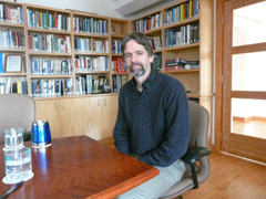
Scott Goetz (Photo Bruce Gellerman)
GOETZ: What you can see is the Amazon basin - you can see logging expansion here and settlers have moved in and you can also see this very large deforestation associated with soy farming.
GELLERMAN: These new space imagers are critical to understanding the causes of climate change and monitoring the damage because under a UN proposed scheme called REDD, Reduced Emissions from Deforestation and Degradation, countries, farmers, ranchers and indigenous groups in rainforests will be compensated for NOT cutting down the forest - keeping the carbon locked in trees. Satellite sensors will reveal how much is there and help establish a baseline to determine if forests are being cut down or destroyed.
Josef Kellndorfer says the orbiting sensors then act as independent, verifiable eyes in the sky to monitor and enforce REDD.
KELLENDORFER: You need that time component, the monitoring component, that’s the beauty of satellite observations that you have time-series that help to detect what the dynamics are of the surface.
GELLERMAN: But to verify what the satellites see from space is really what’s happening in forests, scientists still need people and sensors on the ground. So Woods Hole has begun training people in Congo’s rainforest teaching how to calculate the carbon in trees. Again, Scott Goetz.
GOETZ: And then, of course, what we’re really interested in is taking that to all the other tropical countries making pan-tropical maps of carbon stocks.
GELLERMAN: Is there ever too much information?
GOETZ: I don’t think so. We never seem to get enough.
GELLERMAN: The amount of data from space sensors monitoring the earth is measured in the trillions of gigabits a day and shared internationally.
To coordinate the massive amount of information coming from satellites, ground stations and climate change sensor at sea, the Center for Global Development, NASA and Cisco Systems have just announced a new project called Planetary Skin - fusing the data from all these sensors so the layers can be peeled back by scientists, revealing what’s happening to the planet’s climate.
Nancy Birdsall is president of the Center for Global Development.
BIRDSALL:These investments in information now are absolutely critical now if we’re to have any sort of system at the global level that people in this country and other countries can trust.
[SOUND OF ORBITING CARBON OBSERVER: “… And liftoff of the Taurus rocket with OCO tracking a greenhouse gas of in seek of clues to global warming.”]
GELLERMAN: Space flight, now routine, is still a high-risk venture. Last month NASA’s Orbiting Carbon Observer satellite failed to reach orbit, crashing in Antarctica.
It was a 280 million dollar loss, but what’s at stake from climate change is far greater.
James Fletcher, NASA’s Administrator during the early days of the LANDSAT missions once predicted, “If one space age development would save the world it would be Landsat and its successor satellites.”
Earth does not reveal her secrets easily.
Links
Living on Earth wants to hear from you!
Living on Earth
62 Calef Highway, Suite 212
Lee, NH 03861
Telephone: 617-287-4121
E-mail: comments@loe.org
Newsletter [Click here]
Donate to Living on Earth!
Living on Earth is an independent media program and relies entirely on contributions from listeners and institutions supporting public service. Please donate now to preserve an independent environmental voice.
NewsletterLiving on Earth offers a weekly delivery of the show's rundown to your mailbox. Sign up for our newsletter today!
![]() Sailors For The Sea: Be the change you want to sea.
Sailors For The Sea: Be the change you want to sea.
 The Grantham Foundation for the Protection of the Environment: Committed to protecting and improving the health of the global environment.
 Contribute to Living on Earth and receive, as our gift to you, an archival print of one of Mark Seth Lender's extraordinary wildlife photographs. Follow the link to see Mark's current collection of photographs.
 Buy a signed copy of Mark Seth Lender's book Smeagull the Seagull & support Living on Earth
© Copyright World Media Foundation. All Rights Reserved
Home | Contact | RSS | Donate | Newsletter