Big El Niño Coming?
Air Date: Week of April 4, 2014

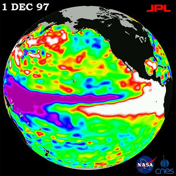
An image of the Pacific Ocean on December 1, 1997 shows sea surface temperatures relative to normal ocean conditions. (NASA)
Conditions in the western Pacific Ocean point to an unusually intense El Niño weather pattern for 2014/15. Climate scientist Kevin Trenberth tells host Steve Curwood that the last extreme El Niño event in 1997/98 coincided with drought in Australia and Africa, severe ice storms in Northeastern North America, and the Pacific Ocean’s most active hurricane year on record.
Transcript
CURWOOD: The weather phenomenon known as El Niño is likely on its way back, and it could be back in a big way over the next year or two, thanks to conditions researchers are now observing in the tropical Pacific Ocean. And if El Niño does return it could intensify droughts and storms around the world. To lay out all the signs and symptoms, we turn to Kevin Trenberth. He’s a distinguished scientist in the climate analysis section at the National Center for Atmospheric Research.
TRENBERTH: El Niños occur about every three to seven years and in between times there is a build up of heat in the western Pacific. The trade winds blow across the Pacific, piling up warm water in the western Pacific. After a period of time, the ocean says ‘there’s too much warm water piling up here over by Indonesia, and I’m going to have an El Niño event’, and some of this warm water starts to spread back across the Pacific and the winds change as that happens. Then, once it gets rolling, it continues for nine months to a year.
CURWOOD: What are the signs you’re seeing right now that suggest an El Niño event is underway?
TRENBERTH: Firstly, this is the right time of year for the transition. The main time when El Niño tends to get started is March, April, May, so this is certainly the time to watch. The second thing is that there have been a quick reversal of the normal easterly trade winds to brief westerly wind bursts.
CURWOOD: And what about water temperatures? What are you seeing there that might suggest that an El Niño is starting?
TRENBERTH: Well, certainly the upper layer of the ocean down to what oceanographers call the thermocline is quite warm and some of the temperature anomalies there are up to about eight degrees Fahrenheit above normal. The last time we’ve seen those kinds of numbers is 1997, 1998, during the big El Niño event. That’s the time when El Niño really came into the American vernacular.
CURWOOD: So tell us, what type of weather might we expect then if it turns out to be a fuerte El Niño?

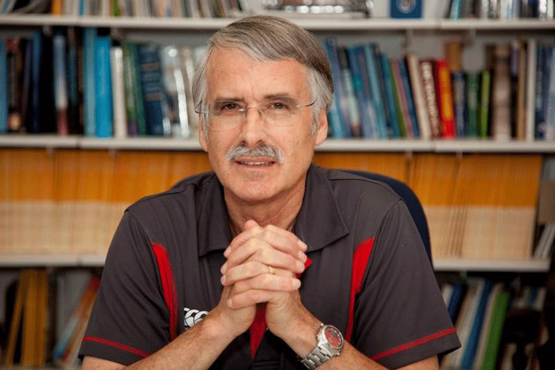
Kevin Trenberth is a Distinguished Senior Scientist in the Climate Analysis Section at the National Center for Atmospheric Research. (NCAR)
TRENBERTH: Well, the first thing is this upcoming summer. If it warms up sufficiently by July, then it means that the Pacific is where the main action is. At the same time, there’s a lot less action in the Atlantic, so a subdued Atlantic hurricane season is in the cards in that case. 1997, as a case in point, is the most active hurricane season ever on record. The places where the hurricanes and typhoons tend to occur is a bit different. There’s a greater risk of a hurricane going into Hawaii or into Tahiti. And then, as we go into the wintertime, there’s much greater odds of storms barreling into southern California and some parts of those continue across the south even to Florida, much wetter conditions in Florida and at the same time warmer and somewhat dryer conditions in the northern plain states.
CURWOOD: Now, to what extent is this good news for California? California’s been really tight on water these days...a lot of drought. Does a big El Niño...how much wetter might it become?
TRENBERTH: Well, this is especially, in some ways, good for southern California. It can end up replenishing a lot of their water resources and filling up reservoirs and so on. At the same time, some of these storms can be quite severe. There’s likely to be coastal erosion. There can also be flooding events. So the ability to be able to manage these kinds of extremes - the short-term extremes for the benefit of the longer term water use - comes into play.
CURWOOD: Now what about the rest of the world? How does this affect drought in places like Brazil and Africa, Australia?
TRENBERTH: The first place, Australia, it greatly increases the risk of drought there, and they’ve already had the warmest year on record in 2013 with quite a lot of reports of wildfires and with El Niño, this greatly exacerbates that kind of a problem. It also affects Southeast Asia and Indonesia, and increases the risk of fires in those places, as well as, especially the northeastern part of Brazil and parts of Africa are very much at greater risk of drought. At the same time, places like Peru and Ecuador are potentially in for deluges and flooding and big changes there.
CURWOOD: Now, as I recall, back in 1998, there was this huge set of icestorms in the east, and the finger was pointed at El Niño.
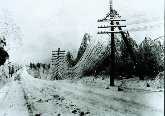
TRENBERTH: Yes, there were some unusual conditions. So it was relatively warm in many parts of the world, because one of the things that happened during El Niño is this heat spreads across the Pacific. It comes into the atmosphere mainly in the form of evaporative cooling of the ocean and more moisture in the atmosphere, so that invigorates storm systems and weather systems, but it ends up heating the atmosphere and there’s a mini global warming. 1998 was the warmest year on record. In winter, we still have cold continental conditions, of course. But sometimes, this warm air can meet up with that, and one of the consequences, - I think it was January 1998 - was a major ice storm, one of the worst on record in New England, and New York and especially in Canada. It caused major dislocations. It brought down the whole poles and structures that the wires were suspended on.
CURWOOD: To what extent do you think the climate change warming of the world’s oceans is a factor in more frequent or stronger El Niño events?
TRENBERTH: This is very hard to tell, and it’s a very important question. What we can say is that when an El Niño happens, because of climate change, the floods and the droughts in different places around the world tend to be stronger than they otherwise would be. And so those are often things which are often quite difficult to manage and they can cause big disasters. We’ve just seen the kind of things that can happen in the Seattle area with this big mudslide, for instance, with some loss of life there. And so, yes, watch out for these kinds of things.
CURWOOD: So, El Niño coming...strap yourself in, huh?
TRENBERTH: Well, yes, as I say, the technology we have nowadays means that we should be able to get a pretty good handle on whether this is really going to happen, and what it looks like, I think, in about a couple of months of so. We’re almost guaranteed that this next year will be rather different than the last three or four that we’ve had at least.
CURWOOD: Kevin Trenberth is a distinguished senior scientist in the climate analysis section at the National Center for Atmospheric Research. Thanks so much for taking the time with us today, Kevin.
TRENBERTH: You're most welcome.

The 1997 el Niño related ice storm damaged electrical wires in the Northeast. (Wikimedia.org)
Links
Living on Earth wants to hear from you!
Living on Earth
62 Calef Highway, Suite 212
Lee, NH 03861
Telephone: 617-287-4121
E-mail: comments@loe.org
Newsletter [Click here]
Donate to Living on Earth!
Living on Earth is an independent media program and relies entirely on contributions from listeners and institutions supporting public service. Please donate now to preserve an independent environmental voice.
NewsletterLiving on Earth offers a weekly delivery of the show's rundown to your mailbox. Sign up for our newsletter today!
 Sailors For The Sea: Be the change you want to sea.
 The Grantham Foundation for the Protection of the Environment: Committed to protecting and improving the health of the global environment.
 Contribute to Living on Earth and receive, as our gift to you, an archival print of one of Mark Seth Lender's extraordinary wildlife photographs. Follow the link to see Mark's current collection of photographs.
 Buy a signed copy of Mark Seth Lender's book Smeagull the Seagull & support Living on Earth

